
TL;DR
Enterprise drone adoption hinges on selecting the right sensor stack, enforcing survey-grade QA/QC workflows, and navigating complex regulatory and security challenges. Photogrammetry delivers fast, high-accuracy 3D models when RTK/PPK and GCP workflows are enforced; thermal provides quantifiable maintenance triggers; LiDAR solves occlusion problems and enables high-precision mapping under dense vegetation. Software selection determines organizational structure—cloud-native systems like DroneDeploy optimize scalability, while Pix4D and Metashape deliver deep offline precision. However, cloud adoption introduces new security vulnerabilities, and FAA Remote ID broadcasts create real-time operational intelligence risks for enterprise operators. The article provides a complete technical and regulatory roadmap for enterprise asset managers deploying commercial UAS systems.
I. Foundational Principles: Photogrammetry and Drone-Based 3D Modeling for Asset Management
A. Defining Photogrammetry: The Science of Measurement from Imagery
Photogrammetry is fundamentally a technique that leverages photography to derive precise measurements and reconstruct objects and environments in three dimensions.1 Its core operational principle relies on acquiring numerous overlapping images of a subject or area from diverse perspectives. This collection of visual data is then processed to recreate a detailed three-dimensional model.1
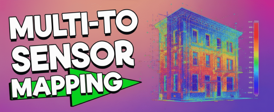
The process begins with the rigorous capture of images, which are subsequently analyzed by highly specialized software.1 This software employs sophisticated $3\text{D}$ reconstruction algorithms designed to identify common visual features—or “matching points”—across multiple photographs. By mathematically resolving the exact location of these corresponding points in $3\text{D}$ space, the software calculates the precise coordinates of every visible feature.2 The immediate result of this processing chain is a dense point cloud, which serves as the foundational data set from which all final $3\text{D}$ models, meshes, and derivative products are generated. Industries ranging from construction to surveying utilize this technology because it delivers results with “survey-grade accuracy” while offering a faster and more cost-effective alternative to conventional ground surveying methods.2
B. UAS Workflow for Asset Modeling and Volumetrics
The successful execution of drone photogrammetry hinges entirely on the diligence applied during the mission planning phase. Achieving geometric accuracy in the final $3\text{D}$ model necessitates rigorous flight planning that dictates parameters such as flight altitude, which defines the Ground Sample Distance (GSD), and crucial image overlap percentages. Standard practice often requires significant overlap—typically $75$ percent front-lap and $65$ percent side-lap—to guarantee that sufficient common points are available for the Structure-from-Motion ($\text{SfM}$) engine to perform accurate triangulation and reconstruction.
One critical consideration for enterprise deployment is that the democratization of high-precision data means that non-geospatial specialists are now generating data that carries the designation of “survey-grade accuracy”.2 While the technology lowers the barrier to generating accurate data quickly, it simultaneously raises the standard for validating its fitness for engineering purposes. If an organization relies on this aerial data for consequential decisions—such as calculating structural deformation or defining legal boundaries—they must rigorously enforce quality assurance and quality control ($\text{QA}/\text{QC}$) protocols. This typically involves the necessary integration of Ground Control Points ($\text{GCPs}$) and high-precision Real-Time Kinematic ($\text{RTK}$) or Post-Processing Kinematic ($\text{PPK}$) workflows to ensure the resulting data is both precise and legally defensible, confirming that the speed advantage realized by UAS deployment does not compromise data quality.
The specialized software generates several high-value outputs essential for asset management:
- Orthomosaics: These are geometrically corrected maps where visual distortions and variations in scale have been mathematically removed, creating a highly accurate, map-ready photographic image.1
- Volumetry: This capability is crucial in resource industries (mining, quarrying, construction) for precise measurement of stockpiles.1 Drone-based volumetric calculations provide highly quantifiable inventory data, dramatically reducing operational uncertainty.
- $3\text{D}$ Modeling: Detailed textured meshes and models are created, allowing for virtual inspection and analysis of complex structures.
C. Practical Applications in Enterprise Asset Management
Drone photogrammetry supports broad applications across numerous engineering and management sectors, including architecture, construction documentation, infrastructure inspection, and resource management.1 Within the enterprise context, the repeated capture of $3\text{D}$ models and orthomosaics over time establishes a longitudinal record that is foundational for advancing to Predictive Asset Management ($\text{PAM}$). By layering and comparing these successive datasets, asset managers can identify minute changes over time, such as sub-centimeter structural shifts, localized settlement, or erosion patterns.1 This historical comparison transforms what would otherwise be a static $3\text{D}$ model into a dynamic dataset, allowing the proactive identification of degradation or failure points in critical assets like transmission lines or bridges, thereby maximizing asset lifespan and minimizing unplanned downtime.3 This capability is instrumental in creating high-fidelity digital twins of physical assets, allowing for virtual measurement and remote condition monitoring.
II. Sensor Technology Deep Dive: Comparative Analysis for Inspection Applications
The selection of the appropriate sensor payload dictates the cost, efficiency, and data utility of any commercial inspection mission. For professional asset management, operators commonly choose among RGB, thermal infrared, or LiDAR, often integrating them for synergistic results.
A. RGB (Visual) Imagery: Context, Cost, and Constraints
RGB cameras represent the most accessible and cost-effective sensors available for UAS platforms. They capture detailed visual context and high-resolution images necessary for $3\text{D}$ mapping.4 The resulting data (color images and video streams) is highly compatible with existing Computer Vision ($\text{CV}$) stacks, giving RGB a high degree of Machine Learning ($\text{ML}$) readiness.5 However, RGB sensors are passive, meaning they rely entirely on external lighting conditions. Their performance is severely degraded by heavy shadow, low light, or inconsistent texture, which can destabilize the $\text{SfM}$ algorithms used in photogrammetry. Consequently, night performance is poor.5
B. Thermal Infrared Imaging: Condition Monitoring and Predictive Maintenance
Thermal infrared cameras measure heat signatures by detecting emitted infrared radiation, allowing the mapping of temperature profiles across an asset’s surface. For enterprise inspection applications, the sensor must possess radiometric capabilities, such as those found in advanced FLIR Boson+ models.6 A radiometric sensor is necessary because it records absolute temperature values, enabling precise, quantifiable temperature mapping that is essential for regulatory compliance, warranty claims, and insurance purposes.
Radiometric data establishes a quantifiable baseline, transforming thermal data collection from a purely diagnostic function into a measurable component of Predictive Maintenance ($\text{PdM}$) strategy. This quantitative data can be integrated directly into maintenance management systems to trigger automated work orders when quantified degradation (i.e., a specific temperature threshold exceedance) is detected.
Key inspection use cases for radiometric thermal imaging include:
- Utility Infrastructure: Identifying overheating electrical components, such as transformers, switchgear, or defects in solar panel arrays.6
- Building Envelope: Mapping thermal anomalies to pinpoint insulation failures, sources of moisture ingress, or roof leaks.6
- Safety and Security: Leveraging excellent night performance for Search and Rescue ($\text{SAR}$) operations by locating heat signatures invisible to $\text{RGB}$.5
C. LiDAR: Precision, Penetration, and Performance in Adverse Conditions
LiDAR ($\text{L}$ight $\text{D}$etection $\text{A}$nd $\text{R}$anging) operates as an active sensor, emitting laser pulses and measuring the time-of-flight to generate highly accurate $3\text{D}$ point clouds.7 LiDAR systems typically deliver “very high” depth accuracy, often achieving resolutions up to $2\text{cm}$ 5, making them indispensable for survey-grade deliverables.
LiDAR is the required technology for applications demanding penetration capability, such as environmental management, forestry, or infrastructure inspection where assets are partially obscured by dense vegetation.7 The ability to record “multiple returns” allows processing software to effectively filter out the vegetation canopy and map the underlying terrain (Digital Terrain Model, or $\text{DTM}$) or structure.7 The economic justification for investing in LiDAR shifts from merely seeking better data quality to fulfilling the necessity of acquiring data that is otherwise impossible to capture with passive $\text{RGB}$ sensors. This investment is warranted when the cost of inaccurate $\text{RGB}$ data or the failure to collect data outweighs the significant hardware acquisition and operational expenses.
Operational trade-offs associated with LiDAR are substantial. These systems incur the highest cost profile (often $\$1,000$ to $\$10,000$ or more per sensor) and have characteristically high power consumption.5 Although they excel in inconsistent lighting conditions compared to $\text{RGB}$ 4, their accuracy can be significantly degraded by specific adverse weather, such as heavy rain or fog.5
D. Multi-Sensor Integration Strategy
The most reliable solution for mission-critical enterprise inspections is often the synergistic integration of multiple sensor types—$\text{RGB}$, Thermal, and LiDAR.8 The $\text{RGB}$ imagery provides color and texture that can be mapped onto the highly accurate depth data captured by LiDAR (geometric structure), resulting in photorealistic and dimensionally accurate $3\text{D}$ models.4 Furthermore, combining panoramic camera views with LiDAR data has been shown to improve calibration and enhance the context required for reliability in dynamic autonomous systems.8
However, the nature of these data streams creates a fundamental paradox for enterprise IT infrastructure planning. $\text{RGB}$ produces vast, large video streams, requiring significant investment in bandwidth and storage.5 Conversely, LiDAR produces smaller point clouds but requires specialized training and different Machine Learning models for interpretation, contrasting with $\text{RGB}$’s use of mature $\text{CV}$ stacks.5 IT planning must therefore balance whether to invest heavily in greater bandwidth and storage for voluminous $\text{RGB}$ data or prioritize investment in specialized cloud computing and $\text{ML}$ expertise necessary for complex LiDAR point cloud processing.
Table 1: Technical and Operational Comparison of Commercial UAS Sensor Systems
| Feature | RGB (Camera-Based Vision) | Thermal Infrared | LiDAR (Laser Scanner) |
| Depth Accuracy | Low (Dependent on Stereo/Processing) 5 | Not Applicable (Temperature) | Very High (Survey-Grade Resolution) 5 |
| Primary Data Output | High-Res Orthomosaics, Visual Context 4 | Radiometric Temperature Data ($\text{T}^{\circ}$ Mapping) 6 | Dense $3\text{D}$ Point Cloud 5 |
| Cost Profile (Sensor only) | Lowest ($\$10–\$100$) 5 | Moderate to High (Radiometrics) | Highest ($\$1,000–\$10,000+$) 5 |
| Resilience to Inconsistent Lighting | Poor (Requires adequate sunlight/texture) | Excellent (Operates day or night) 5 | Excellent (Active Sensor) 4 |
| Power Consumption | Low 5 | Moderate | High 5 |
| Optimal Inspection Use Case | Visual Documentation, Detailed Facade Mapping 1 | Solar/Utility Inspection, Leak Detection, Search-and-Rescue 6 | High-Accuracy Volume Calculation, Dense Canopy Mapping 7 |
III. Data Processing Ecosystem: Automation, Performance, and Accuracy
The choice of flight planning and photogrammetry processing software dictates the efficiency of the workflow, flexibility of integration, and ultimately, the achievable geospatial accuracy of the deliverables.
A. Software Capabilities for Flight Automation and Mission Planning
Modern commercial platforms provide increasingly sophisticated tools for mission execution. Software such as DroneDeploy and DJI Pilot $2$ offers critical features necessary for enterprise operations, including reliable terrain-following, linear or corridor missions (essential for pipelines and transmission lines), and specific tools for vertical mapping and facade inspection.9 DJI Pilot $2$ is often noted for its seamless integration with $\text{DJI}$ hardware, making it highly reliable for simple grid patterns.9
Beyond data capture, platforms like Airdata specialize in fleet compliance and automated logging, offering essential manufacturer agnosticism (supporting $\text{DJI}$, Autel, and Skydio).10 This capability is crucial for large agencies and commercial operators managing diverse or mixed-manufacturer fleets, ensuring compliance across various airframes.
B. Comparative Analysis of Leading Processing Platforms
Centimeter-level accuracy represents the baseline expectation for high-end geospatial data and is attainable across the leading photogrammetry platforms—Pix4D, Agisoft Metashape, and $\text{DJI}$ Terra—provided that $\text{RTK}/\text{PPK}$ workflows are employed alongside carefully placed $\text{GCPs}$.10 However, the strategic advantages and limitations of each platform differ significantly:
- Pix4D (Mapper/Cloud): This suite is renowned for its capacity for “deeper offline control” and its ability to manage rigorous, high-accuracy workflows.10 It is the preferred choice for applications demanding customized precision and research-grade results. Its primary drawback is a moderate processing speed, often requiring powerful local $\text{GPU}$ resources.10
- DroneDeploy: This platform prioritizes speed, accessibility, and collaboration through a polished cloud-native workflow.10 It distinguishes itself by supporting a wider variety of $\text{UAVs}$, making it a hardware-agnostic solution for enterprise use.10 While it achieves good accuracy with $\text{RTK}$-enabled drones, its outputs can be marginally less precise than those from Pix4D or Metashape when dealing with the most demanding geospatial projects.10
- DJI Terra: Designed specifically for the $\text{DJI}$ ecosystem, $\text{DJI}$ Terra offers unmatched processing speed and optimized integration with $\text{DJI}$ hardware and mission planning tools like $\text{DJI}$ Pilot $2$.9 Its primary limitation, however, is its exclusive restriction to the $\text{DJI}$ enterprise platform, severely restricting flexibility for organizations utilizing multi-manufacturer fleets.9
- Agisoft Metashape: Often utilized for academic and highly specialized engineering tasks, Metashape is valued for achieving “research-grade precision,” though its processing speed is typically slower than cloud-based competitors.10
The decision regarding processing software fundamentally dictates the organizational structure of the UAS program. Cloud-centric platforms like DroneDeploy simplify collaboration and centralize data processing 10, favoring models where field teams focus exclusively on data capture, while complex analysis and mapping occur centrally. Conversely, offline-focused tools like Pix4D, which offer deeper control and precision, often require more highly trained personnel in regional offices or the field, demanding a decentralized data processing capability.
C. Geospatial Accuracy and Validation
The strategic choice of software must be weighed against the strategic risk of hardware lock-in. While $\text{DJI}$ Terra offers a compelling speed advantage, its dependency on the $\text{DJI}$ ecosystem is a significant vulnerability.9 If future operational requirements mandate a shift to a specialized, non-$\text{DJI}$ airframe (e.g., for compliance or a unique payload integration like an advanced LiDAR system), an organization standardized on $\text{DJI}$ Terra faces the steep cost of migrating their entire processing infrastructure, incurring licensing expenses and substantial retraining. Organizations prioritizing long-term flexibility and resilience to vendor changes should favor hardware-agnostic solutions.
Achieving the requisite centimeter-level accuracy for engineering projects relies on two critical georeferencing techniques:
- RTK/PPK: These systems utilize external Global Navigation Satellite System ($\text{GNSS}$) correction data to refine the positional accuracy of the camera centers recorded by the drone, dramatically reducing positional error.10
- Ground Control Points ($\text{GCPs}$): Physical targets placed within the survey area, measured with high-precision instruments. These points act as fixed anchors, locking the photogrammetric model to real-world coordinates and providing the essential validation necessary for engineering and surveying deliverables.10
Table 2: Strategic Comparison of Commercial Photogrammetry Software
| Platform | Processing Speed/Workflow | Core Strength Focus | Hardware Agnosticism | Recommended User Profile |
| Pix4D (Mapper/Cloud) | Moderate (High $\text{GPU}$ dependency) 10 | Maximum Accuracy, Offline Control, Deep Customization 10 | High (Supports multi-manufacturer data) | Surveyors, Engineering Firms demanding certified precision |
| DroneDeploy | Fast (Cloud-native Processing) 10 | Collaboration, Scalability, Ease-of-Use 10 | Highest (Supports wide range of $\text{UAVs}$) 10 | Enterprise Fleet Managers, Large Construction Projects |
| DJI Terra | Fastest (For $\text{DJI}$ datasets) 10 | Optimized Integration, $\text{RTK}$ Accuracy within Ecosystem 10 | Low (Limited to $\text{DJI}$ enterprise platforms) 9 | Operators with $100$ percent $\text{DJI}$ Fleet Standardization |
| Agisoft Metashape | Slower but highly precise 10 | Research-grade Precision, Complex Reconstruction | High | Academic Researchers, Specialized Geospatial Analysts |
IV. Data Security, Privacy, and Regulatory Compliance Challenges
For commercial drone operators, the adoption of scalable data infrastructure and the adherence to federal mandates like $\text{FAA}$ Remote $\text{ID}$ ($\text{RID}$) introduce significant data security and privacy challenges.
A. Cloud Platform Adoption: Benefits and Inherent Security Risks
Cloud storage is highly favored by drone operators due to the structural benefits it offers, including unparalleled scalability to store terabytes or petabytes of data, robust redundancy (storing multiple secure copies), organization via metadata tagging, and real-time remote access.11 Cloud providers significantly enhance security by offering advanced encryption protocols and strict access controls, sometimes allowing the segregation of sensitive flight data from manufacturer logs to improve both privacy and security.11 This robust infrastructure, supported by constant monitoring, substantially lowers the risk of hardware-related data loss or unauthorized access compared to physical storage systems.11
Despite these benefits, relying on a shared resource environment introduces inherent security risks common to cloud computing: data breaches, challenges to data confidentiality and access controllability, inadequate due diligence, and authentication vulnerabilities such as phishing and key exposure.12 Centralizing high-value data—such as proprietary thermal imagery, $3\text{D}$ models of critical infrastructure, and operational logs—creates a concentrated target, meaning that any security failure has an amplified impact across the organization.
B. Ecosystem-Level Security Threats
Security vulnerabilities for commercial operators extend beyond traditional $\text{IT}$ infrastructure to the physical drone ecosystem itself. The mobility of $\text{UAS}$, often operating beyond the physical control of the operator, makes them susceptible to remote or physical capture.13 An adversary who gains access to a captured drone can access information stored onboard, regardless of external regulations like $\text{RID}$.13
A critical and often overlooked confidentiality risk stems directly from the supply chain: drone manufacturers, who are often geographically dispersed, typically retain “remote access and super-user privileges”.13 These privileges are maintained for essential activities such as diagnostics, maintenance, and mandatory firmware updates, sometimes facilitated via cellular network connections.13 This inherent privilege creates a persistent security vector. Commercial operators must therefore implement a Zero-Trust Model regarding their own manufacturer’s access, recognizing that the security perimeter must encompass vendor risk management. This necessitates using compliant hardware and contractually limiting the scope of remote access, especially for platforms where the segregation of highly sensitive operational logs from standard manufacturer telemetry is not feasible.11
C. FAA Remote ID Requirements and Privacy Compromise
The $\text{FAA}$ Remote $\text{ID}$ ($\text{RID}$) rule was mandated by Congress to establish safety and national security groundwork, requiring registered drones to function as a “digital license plate” that helps authorities locate control stations when unsafe flight occurs.14 Compliance became mandatory for registered operators on March $16$, $2024$.14
While the industry largely supported $\text{RID}$ for safety and operational efficiency, the final rule failed to fully correct critical privacy concerns.15 The rule specifies that the operator’s personal identification data is not revealed to the general public.15 However, $\text{RID}$ requires the public broadcast of both the physical location of the drone ($\text{UAS}$ location) and, critically, the physical location of the drone’s operator (Control Station Location).15
This public broadcast of the control station location fundamentally shifts the security paradigm from traditional risks associated with data storage to real-time risk of operational intelligence leakage. An adversary does not need to compromise a corporate server; they can simply listen to the public $\text{RID}$ broadcast to identify precisely where a company is performing a high-value inspection, conducting sensitive research and development, or securing critical infrastructure.15 This vulnerability poses a direct threat of corporate espionage.15 Furthermore, for missions involving last-mile delivery, the public location data compromises the consumer’s “right to privacy” by linking flight paths and operator locations to specific private residences or business addresses.15 Industry groups, such as the $\text{NBAA}$, continue to advocate strongly that Control Station location data should be accessible only to law enforcement, security agencies, and the $\text{FAA}$, not the general public.15
Table 3: Cloud Data Management vs. FAA Remote ID: Risk and Compliance Analysis
| Dimension | Cloud Data Platforms | FAA Remote ID (RID) Compliance |
| Data Handling | Centralized storage, encryption, access control 11 | Real-time broadcast of location data (Drone & Control Station) 15 |
| Primary Security Benefit | Scalability, redundancy, and centralized application of encryption 11 | Accountability for airspace safety and national security monitoring 14 |
| Primary Privacy Concern | Shared resource environment, risk of manufacturer super-user access 13 | Public disclosure of operational site and operator location 15 |
| Mitigation Strategy | Implementation of strict access controls, segregated storage for sensitive logs 11 | Advocacy for restricted public access to Control Station data (Law enforcement/FAA only) 15 |
V. Conclusion and Strategic Recommendations
The modern commercial application of unmanned aircraft systems for asset management is defined by the integration of advanced sensors and high-precision photogrammetric processing, yet its efficacy is intrinsically linked to navigating complex operational and regulatory security challenges.
Photogrammetry provides the foundational methodology for creating survey-grade $3\text{D}$ models that are faster and more affordable than traditional surveying, enabling critical functions like volumetrics and digital twin creation.1 However, achieving true engineering reliability requires strict adherence to $\text{RTK}/\text{PPK}$ workflows and $\text{GCP}$ validation. The choice of sensor must be mission-driven: $\text{RGB}$ for visual context and cost efficiency, radiometric thermal for quantifiable Predictive Maintenance $\text{ROI}$, and LiDAR only when penetration of dense environments or extreme depth accuracy is an essential requirement.5
The selection of data processing software determines the fleet’s strategic flexibility. Organizations must weigh the optimized speed of vendor-locked systems like $\text{DJI}$ Terra against the long-term resilience and platform agnosticism offered by solutions like Pix4D or DroneDeploy, which protect against future hardware dependency.9
Finally, the regulatory landscape introduces critical security vulnerabilities that commercial operators must address. While cloud platforms provide essential scalability and centralized encryption, they amplify the consequences of any single security failure.12 More immediately concerning is the $\text{FAA}$ Remote $\text{ID}$ rule, which, by publicly broadcasting the operator’s control station location, creates a significant avenue for corporate espionage and real-time operational intelligence leakage, directly threatening confidential business information.15
Based on this analysis, the following strategic recommendations are provided for commercial $\text{UAS}$ program managers:
- Mandate Sensor-Specific $\text{QA}/\text{QC}$: For all structural or survey-grade deliverables, mandate $\text{GCPs}$ and $\text{RTK}/\text{PPK}$ workflows, regardless of the vendor software used. Ensure that thermal sensors utilized for $\text{PdM}$ are radiometric to convert diagnostic data into quantifiable, audit-ready maintenance triggers.
- Prioritize Hardware Agnosticism: Favor photogrammetry processing platforms that support multi-manufacturer fleets (e.g., DroneDeploy or Pix4D) over vendor-specific platforms ($\text{DJI}$ Terra). This strategy preserves the organizational freedom to adopt specialized, $\text{NDAA}$-compliant, or unique $\text{LiDAR}$ payloads in the future without incurring complete workflow migration costs.
- Implement Vendor Zero-Trust and Data Segregation: Recognize the inherent risk posed by manufacturer-retained remote access privileges.13 Segregate highly sensitive operational logs and project data from standard manufacturer telemetry uploads where possible, and establish strict contractual limits on vendor data access and retention.11
- Mitigate $\text{RID}$ Operational Leakage: Acknowledge that the public broadcast of the control station location is a non-negotiable security risk under current $\text{FAA}$ rules. Operational planning must account for this, ensuring that the control station is located at non-sensitive or secured staging areas to prevent malicious actors from tracking high-value inspection targets based on the publicly available $\text{RID}$ signal.
Works cited
- Everything you need to know about drone photogrammetry, accessed October 31, 2025, https://www.dronexperts.com/en/article/everything-you-need-to-know-about-drone-photogrammetry/
- Photogrammetry software: complete guide for accurate 3D mapping and reconstruction – DroneDeploy, accessed October 31, 2025, https://www.dronedeploy.com/blog/photogrammetry-software-complete-guide-for-accurate-3d-mapping-and-reconstruction
- Drones are soaring, but privacy protections lag behind, says ASU expert, accessed October 31, 2025, https://news.asu.edu/20251028-law-journalism-and-politics-drones-are-soaring-privacy-protections-lag-behind-asu-expert
- Differences between RGB and LiDAR sensors – HPDRONES, accessed October 31, 2025, https://hp-drones.com/en/differences-between-rgb-and-lidar-sensors/
- Cameras vs LIDAR: The Battle for Vision in Autonomous Vehicles – ArcadianAI, accessed October 31, 2025, https://www.arcadian.ai/blogs/blogs/cameras-vs-lidar-the-battle-for-vision-in-autonomous-vehicles
- The 7 Best Thermal Drones to Buy [2025], accessed October 31, 2025, https://www.thedroneu.com/blog/thermal-drones/
- Choosing the Right Drone Based LiDAR System – Measur Drones, accessed October 31, 2025, https://measur.ca/blogs/news/choosing-the-right-drone-based-lidar-system
- LiDAR-360 RGB Camera-360 Thermal Camera Targetless Calibration for Dynamic Situations – PMC – PubMed Central, accessed October 31, 2025, https://pmc.ncbi.nlm.nih.gov/articles/PMC11598782/
- Best Drone Mapping Software [2025]: Tested Picks & How to Choose – SPH Engineering, accessed October 31, 2025, https://www.sphengineering.com/news/best-drone-mapping-software
- Top Drone Mapping Software Compared – DSLRPros, accessed October 31, 2025, https://www.dslrpros.com/blogs/drone-trends/drone-mapping-software-comparison-guide
- How Cloud Storage Simplifies Drone Data Management | Anvil Labs, accessed October 31, 2025, https://anvil.so/post/how-cloud-storage-simplifies-drone-data-management
- Cyberattacks and Security of Cloud Computing: A Complete Guideline – MDPI, accessed October 31, 2025, https://www.mdpi.com/2073-8994/15/11/1981
- Privacy and Confidentiality Issues in Drone Operations: Challenges …, accessed October 31, 2025, https://ssciancalepore.win.tue.nl/publications_pdf/2024_Sciancalepore_NETWORK.pdf
- FAA Ends Discretionary Enforcement Policy on Drone Remote Identification, accessed October 31, 2025, https://www.faa.gov/newsroom/faa-ends-discretionary-enforcement-policy-drone-remote-identification
- Privacy, Security Concerns Remain Regarding UAS Remote … – NBAA, accessed October 31, 2025, https://nbaa.org/aircraft-operations/emerging-technologies/uas/nbaa-privacy-security-concerns-remain-regarding-uas-remote-id-final-rule/