
TL;DR — Executive Summary
Professional UAS operators must prevent both physical bird strikes and disturbance of protected wildlife, which is a federal offense even without contact. This Standard Operating Procedure (SOP) integrates aviation rules with ecological protection requirements to ensure safe, legal, science-based flight planning.
Key Practices
- Conduct pre-flight ecological assessments, especially during nesting/migration seasons.
- Maintain Minimum Approach Distances (MADs) based on species + activity (e.g., ~100m general wildlife; >300m near raptors).
- Use geofencing & predictive models to avoid high-risk habitats.
- Prioritize quieter platforms + smooth, predictable flight paths to reduce stress.
- Deploy trained Visual Observers (VOs) in high-risk areas; do not rely solely on detect-and-avoid systems.
- If birds approach aggressively → execute rapid vertical ascent (best-proven evasion).
- Document all encounters; report strikes to FAA (Form 5200-7).
Bottom Line:
This SOP framework protects wildlife, satisfies federal law, and minimizes operational risk by pairing biological science + aviation safety + procedural discipline.
I. Foundational Principles and Regulatory Compliance
The successful and ethical operation of Unmanned Aerial Systems (UAS) in airspace shared with avian wildlife depends upon strict adherence to a dual mandate: ensuring aviation safety and upholding stringent conservation laws. Professional operators must understand that legal compliance extends beyond merely meeting the requirements of the national aviation authority to encompass ecological protection standards enforced by conservation agencies.
A. Legal and Ethical Imperatives for Avian Protection
The operation of a UAS must prioritize the protection of wildlife, particularly in ecologically sensitive environments. Legal frameworks explicitly prohibit the pursuit, harassment, or intentional disturbance of animals, especially when they are engaged in critical life history functions such as breeding, nesting, or rearing young.1 Violation of these conservation statutes is not a minor infraction but an actionable offense that can result in heavy fines and, in severe cases, criminal prosecution.2
Many avian species, especially raptors like eagles, are protected under foundational U.S. federal laws, including the Bald and Golden Eagle Protection Act and the Migratory Bird Treaty Act.2 These species, though having successfully rebounded in population, remain highly vulnerable to disturbance, particularly during nesting. For instance, eagles defending a nest often perceive drones and associated noise as a threat, resulting in detrimental outcomes such as energy depletion, egg failure, or the death of eaglets.2 Consequently, regulatory compliance requires satisfying both aviation governance (e.g., the FAA) regarding airspace use and conservation bodies (e.g., the USFWS) regarding wildlife welfare. A flight operating below the standard 400 feet AGL limit 1, while meeting aviation requirements, is illegal if it simultaneously harasses a protected species, underscoring the necessity of comprehensive, dual-compliance SOPs.
B. Federal and International Regulatory Landscape
Compliance protocols must navigate a complex mosaic of regulations based on jurisdiction and land designation.
1. U.S. Federal Aviation and Conservation Authority
In the United States, the Federal Aviation Administration (FAA) establishes core airspace restrictions, mandating that UAS operations remain below 400 feet AGL and maintain separation from surrounding obstacles.1 Furthermore, flight must maintain separation of at least 5 miles from an airport or backcountry airstrip.1
Crucially, the U.S. Fish and Wildlife Service (USFWS) and the U.S. Department of Agriculture (USDA) Forest Service implement strict prohibitions on UAS activity within protected lands. It is illegal to launch, land, or disturb wildlife by UAS on National Wildlife Refuges (NWRs).2 Similarly, operation is prohibited within congressionally designated Wilderness Areas or Primitive Areas, as UAS are classified as both “motorized equipment” and “mechanical transport”.1 Operators must exercise caution regarding navigational tools; commercial applications designed for general UAS use (e.g., AirMap or DJI Go) do not always capture accurate locations of public lands where UAS use is strictly prohibited.4 Verification with refuge managers or agency-specific maps is mandatory before undertaking missions near such sensitive areas.
2. International and Jurisdictional Regulations
International regulatory bodies reflect similar sensitivities. The European Union Aviation Safety Agency (EASA) classifies drone operations into three risk categories—Open, Specific, and Certified—with the Specific category requiring risk assessment and operational authorization for complex missions.5
In Australia, the Civil Aviation Safety Authority (CASA) emphasizes that environmental laws enacted by states and territories dictate mandatory separation distances from wildlife. For example, specific jurisdictions require distances of 100 meters to 300 meters from marine mammals.7 The presence of aggressive raptors, such as eagles, hawks, and falcons, is also noted as a risk factor, as these birds commonly target UAS perceived as threats.7
C. Definition of Avian Incidents: Distinction between Disturbance, Harassment, and Strike
Standard operating procedures must define three distinct levels of avian interaction severity to ensure proper mitigation and reporting:
- Disturbance: This refers to any observable change in avian behavior resulting from the presence of the UAS. Indicators of disturbance include alert behavior (e.g., head-turning, raising the head, tensing the body), increased vigilance, or localized movements such as standing at or walking away from a nest.8 Even in the absence of visible flight or escape, low-level disturbance can induce physiological stress responses in birds.10
- Harassment: This constitutes intentional or persistent disturbance that causes significant harm, especially when affecting breeding or nesting outcomes, potentially resulting in nest abandonment or death.2 Harassment often crosses the threshold for legal prosecution under wildlife protection acts.
- Strike/Collision: This is physical contact between the UAS and avian life. Strikes can damage the drone’s components (propellers, sensors, motors), leading to a loss of control, and simultaneously injure or kill the bird.11 In the United States, physical strikes must be reported to the FAA using Form 5200-7, which contributes data to the national Wildlife Strike Database.13
II. Biological Risk Assessment and Ecological Data Integration
Effective UAS operation requires a scientific approach to managing interactions with wildlife, moving beyond simple avoidance to quantitative risk prediction based on avian biology.
A. Understanding Avian Vulnerability
Birds exhibit heightened sensitivity to disruption during specific phases of their life cycle. The risks associated with UAS operations are highest during nesting, rearing of young, and periods of seasonal migration.2 Raptors, in particular, are highly territorial during nesting and actively defend their nests, viewing drones as potential aerial threats.2
Drone operations generate disturbances via two primary mechanisms:
- Acoustic Stressors: Small UAS propellers generate significant noise, typically ranging from 70 to 90 dB at hover, with distinct tonal peaks at blade passage frequencies.14 This acoustic signature disrupts vital avian functions such as communication, mate attraction, territory defense, foraging, and predator avoidance.10 Chronic exposure to this noise can lead to habitat displacement and reduced reproductive success.10
- Visual and Behavioral Stressors: The visual presence of a drone, especially during maneuvers, triggers stress responses.9 Birds may perceive a UAS as a flying predator or a novel aerial object.15 Studies have indicated that the shape and wing profile of certain drones—particularly those resembling raptors—increase disturbance.9 Furthermore, specific dynamic flight patterns, such as banking maneuvers, rapid takeoffs, or landings, can be interpreted by birds as resembling the swooping action of a predatory bird, causing heightened vigilance and escape behavior.9
The complexity of these interactions—where an object may not be considered a typical predator yet still triggers severe defensive responses—necessitates flight procedures that prioritize smooth, predictable, and non-aggressive movements to minimize visual threat perception.9
B. Quantifying Safety Buffers: Application of Flight Initiation Distance (FID) Data
To mitigate disturbance, operators must establish robust safety buffers using ecological data. The Flight Initiation Distance (FID) is a critical metric, defined as the distance at which an animal initiates escape behavior when approached by a perceived threat, serving as a proxy for tolerance.8 Minimum Approach Distances (MADs) are derived from FID studies to ensure the UAS maintains a separation that avoids triggering flight or severe behavioral reaction.8
A general, conservative distance guideline requires launching the UAS and maintaining operation at least 100 meters (328 feet) from observed wildlife.3 However, this distance must be dynamically adjusted based on species, activity, and altitude. Research indicates that disturbance effects are strongly linked to proximity, with flights at or below 50 meters showing significantly stronger disturbance effects, especially on ground solitary and non-ground solitary nesters.18 For nesting birds, protective buffers derived from FID studies often range between 100 and 180 meters.19
Professional SOPs must therefore mandate a system of tiered, dynamic buffers that account for the specific ecological context.
Table 1: Species-Specific Minimum Approach Distances (MAD) for UAS Operations
| Avian Scenario/Group | Activity Status | Recommended Minimum Approach Distance (MAD) | Regulatory/Ecological Rationale |
| General Wildlife (Non-Nesting) | Observation/Foraging | 100 meters (328 ft) | Standard conservative buffer to prevent flushing 3 |
| Ground Solitary/Non-Ground Nesters | Nesting/Rearing Young | > 50 meters minimum; 100–180m preferred | High odds of disturbance at lower altitude; required protective buffers 18 |
| Colonial Nesters (Ground) | Nesting/Rearing Young | > 50 meters suggested | Demonstrated lower evidence of disturbance at lower altitudes compared to solitary nesters 18 |
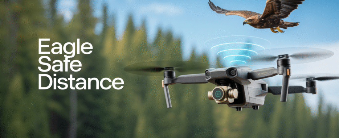
| Eagles and Raptors | Nesting/Territorial Defense | > 300 meters (FWS Coordination Required) | Highly territorial, high risk of attack, and severe legal consequences 2 |
| Specific Marine Mammals (e.g., North Atlantic Right Whales) | General | 500 yards (457 meters) | Mandatory U.S. Federal regulation 21 |
C. Integrating Predictive Data for Avian Hazard Forecasting
Advanced operational programs integrate real-time ecological data streams to move from reactive avoidance to proactive hazard forecasting. This involves leveraging predictive ornithology models that use machine learning algorithms, such as Convolutional Neural Networks (CNN) and YOLO methods, to analyze multi-sensory data (visual, thermal, acoustic).22 These models are capable of identifying bird species, tracking individual birds or flocks, and correlating movements with environmental variables like weather and vegetation.22 This capability allows operators to forecast bird migration intensity and routes days or weeks in advance, enabling flight planning to avoid known feeding grounds or major migratory corridors.22 Incorporating such predictive systems into pre-flight planning is a foundational requirement for operations in high-risk, unpredictable environments.
III. Pre-Flight Planning and Hazard Identification SOPs
The successful mitigation of avian conflict begins with a rigorous, structured pre-flight assessment that integrates environmental conditions and biological hazards into the operational plan.
A. Mission Scoping and Ecological Calendar Integration
Mission planning must be synchronized with the regional ecological calendar. Flights should be scheduled to avoid peak avian activity times, which typically occur during the early mornings and late afternoons when birds are actively foraging.24 Opting for quieter periods, such as the middle of the day, reduces the likelihood of encounters.25
When operations are unavoidable during critical periods, such as breeding and nesting seasons, specialized protocols apply.26 If activities cannot be postponed, mandatory avian surveys must be conducted no more than five days prior to the scheduled flight activity to determine if active nests or breeding behaviors are present within the operational area.20 If active nests are detected, a buffer zone must be established around the nest, prohibiting all activity until nestlings have fledged or the nest is confirmed to have failed.20 Finally, the launch and recovery of the UAS must be performed at a minimum distance of 100 meters (328 feet) from any observed wildlife to prevent initial startling disturbance.3
B. Site-Specific Avian Risk Assessment Checklist
A formal risk assessment matrix must be utilized to systematically evaluate the probability and severity of potential avian incidents.27 This process requires identifying specific hazards at the mission site. The most common hazards identified during site assessments include areas with bodies of water (which attract large flocks), known raptor roosts, and areas of dense population or turbulence near tall structures.29
A critical consideration in UAS operations, distinct from manned aircraft safety, is the elevation of ecological disturbance risk within the hazard management matrix. Traditional Bird Aircraft Strike Hazard (BASH) assessment focuses primarily on the severity of physical damage to the aircraft and subsequent risk to human safety.30 However, given the severe legal ramifications associated with disturbing protected nesting species 2, the risk matrix used for UAS must assign high severity to the likelihood of ecological disturbance, even if the probability of a physical strike remains low. This approach ensures that mitigation strategies prioritize environmental protection equally with physical collision avoidance.
Table 2: Avian Hazard Management Pre-Flight Checklist (Risk Matrix Inputs)
| Assessment Factor | Checklist Item | Mitigation Requirement (Pre-Flight) | Supporting Reference |
| Airspace/Regulation | TFRs, Wilderness Areas, National Wildlife Refuges checked? | Flight prohibited or requires specific authorization/waiver. Manual boundary verification required.1 | 1 |
| Seasonal Timing | Is operation within known local migration/nesting season? | Schedule flight for mid-day; implement nest surveys and coordinate with local FWS/biologists. Buffer zones established.20 | 20 |
| Habitat Identification | Are high-risk areas (water bodies, known roosts, dense canopy) within the flight path? | Adjust flight paths to provide maximum lateral and vertical distance. Utilize predictive models if available.22 | 22 |
| Altitude Risk | Will the flight path maintain > 50m separation from critical habitat? | Use flight planning software to ensure maximum feasible altitude (up to 400 ft) to reduce disturbance effects.18 | 1 |
| Crew & Equipment | VO assigned, trained, and briefed? DAA systems operational? | VO essential for maintaining situational awareness and obstacle/wildlife avoidance.12 | 12 |
C. Geofencing Implementation for Conservation Areas and Nesting Sites
Geofencing technology is an essential tool for enforcing conservation-based buffer zones.32 By setting virtual boundaries around sensitive conservation areas or known protected nesting zones, geofencing systems can restrict access and provide proximity alerts.33 This implementation is critical for integrating real-world ecological boundaries with flight control software, ensuring the UAS autonomously respects the required Minimum Approach Distance (MAD). Furthermore, geofencing allows wildlife management authorities to establish early warning systems against unauthorized access to habitats.32 It is imperative that these geofencing systems be layered with the most accurate regulatory data, including prohibitions on public lands, rather than relying solely on default manufacturer databases.4
IV. Advanced Mitigation Technologies and Hardware Specifications
Technological integration provides necessary layers of safety beyond procedural compliance, specifically targeting the reduction of acoustic and visual disturbance.
A. System Selection: Minimizing Acoustic Signature
The acoustic signature of a UAS is a primary driver of avian stress and disturbance.10 SOPs for mission deployment must therefore mandate the prioritization of platforms engineered for low noise emission. Drone propellers typically generate noise levels between 70 and 90 dB at hover.14
Hardware mitigation efforts focus on modifying rotor geometry and operational parameters. Research has successfully demonstrated noise reduction through bio-inspired modifications, such as incorporating a leading edge comb similar to those found on owl flight feathers.34 Other effective aerodynamic innovations include swept-blade designs, optimized tip geometry, and serrated blade surfaces, all aimed at minimizing the acoustic signature while maintaining necessary aerodynamic efficiency.14 Utilizing smaller, quieter drones reduces the likelihood that the UAS is perceived as a threat or prey, thereby lowering the probability of a defensive attack by territorial birds.11
B. Onboard Sensing and Detect-and-Avoid (DAA) Systems
Detect-and-Avoid (DAA) systems are fundamental for professional UAS operations, allowing unmanned vehicles to recognize surrounding objects autonomously and initiate avoidance maneuvers to ensure safety.35 For avian conflict mitigation, DAA must rely on sensor fusion and specialized detection software.
- Advanced Sensing: Avian DAA utilizes high-resolution cameras integrated with computer vision algorithms, such as YOLO, which are highly effective for real-time bird detection and identification.23 Thermal imaging sensors augment this capability by detecting heat signatures, proving invaluable for nocturnal operations or migration monitoring when visible light is limited.36 Furthermore, specialized surveillance radar systems, such as the MERLIN Bird and Drone Detection Radar (BDR-DDR), are employed in high-risk settings (e.g., airports) to track large flocks or single birds in real time.37
- Technological Gap in Avian Mitigation: While sophisticated, many standard commercial DAA systems are primarily optimized for large, slow-moving obstacles such as terrain features or other unmanned vehicles.35 The detection and high-speed tracking of small, fast-moving birds remains a significant challenge. Consequently, SOPs must acknowledge the inherent limitations of automated DAA systems in this context. The ultimate responsibility for nuanced ecological avoidance remains with the human flight crew. This means the use of a trained Visual Observer (VO) is not just beneficial for general airspace awareness but is paramount for effective, real-time avian mitigation.31
V. In-Flight Standard Operational Procedures
In-flight protocols govern real-time decision-making, crew coordination, and tactical response to active avian encounters.
A. Crew Roles and Responsibilities
During any UAS mission conducted in an environment where avian encounters are plausible, a formalized crew structure is required to maximize situational awareness:
- Remote Pilot in Command (RPIC): The RPIC maintains responsibility for the ultimate safety of the operation and legal compliance. The RPIC must continuously synthesize data received from the UAS telemetry, DAA systems, and the Visual Observer (VO).
- Visual Observer (VO) Protocol: While not required by the FAA for all missions, the VO is mandatory in high-risk avian environments, serving as a critical second set of eyes.31 The Scanner VO continuously scans the surrounding airspace and ground for potential hazards, including flying birds or bird congregations.31 All information relayed by the VO must correspond accurately to the RPIC’s position, ensuring accurate situational awareness and swift reaction.31 The presence of a VO significantly increases the ability of the team to detect birds quickly and initiate avoidance maneuvers before the Minimum Approach Distance is breached.11
B. Adaptive Buffer Protocols and Tiered Observation
In-flight operations must rigidly adhere to the dynamic MADs established during pre-flight risk assessment (Table 1). Continuous, real-time monitoring of avian reaction is required.
For missions involving deliberate observation of wildlife (such as ecological surveys), a disciplined tiered descent protocol must be employed to minimize disturbance:
- High Altitude Initiation: Begin observation at a conservative, high altitude, such as 80 meters.39
- Gradual Descent: Descend incrementally, only proceeding to a lower altitude if the animals display no visible signs of stress.39
- Stress Response Action: If any alert behaviors are observed (e.g., scanning, tensing, or walking away from a nest) 8, the descent must be immediately halted, and the altitude or lateral distance must be increased.39 Operators must maintain conservative operation standards, recognizing that stress may be induced even without immediate, visible reaction.39
C. Tactical Response to Avian Encounters
Encountering raptors or other aggressive birds demands a specific, immediate tactical response to prevent collision and harassment. Raptors often view drones as territorial threats and are prone to attack, which typically ends with the drone being struck and possibly grounded.11
- Immediate Evasion Tactic: If a bird approaches the UAS aggressively or initiates an attack, the RPIC must execute an immediate, rapid vertical ascent. This maneuver is empirically effective because birds, particularly raptors, have a difficult time executing a straight vertical climb compared to lateral or diving attacks.11 Rapid vertical ascent is the best tactic for quickly disengaging and preventing a physical strike. Lateral evasion should be avoided, as it increases the risk of misjudging velocity and collision.
- Environmental Flight Path Discipline: To minimize visual disturbance, the RPIC must maintain smooth, predictable flight paths. Abrupt maneuvers, such as sudden banking or rapid changes in velocity, mimic predatory behavior and should be strictly avoided.9 Furthermore, operators must never fly directly over large congregations of birds or known nesting sites, maintaining substantial lateral separation even when flying at the maximum allowed altitude, thereby minimizing auditory impact.18
VI. Post-Flight Analysis and Incident Reporting Framework
A rigorous post-flight regime is fundamental for maintaining accountability, ensuring regulatory compliance, and driving the continuous improvement of safety management systems.
A. Mandatory Reporting of Avian Strikes and Near-Misses
The process of incident reporting is bifurcated, addressing both physical strikes (aviation safety) and behavioral disturbances (ecological compliance).
- Physical Strike Reporting (FAA): Any physical collision with avian life must be reported immediately. The official mechanism is FAA Form 5200-7 (Bird and Other Wildlife Strike Report), which should be submitted online to the Wildlife Strike Database.13 If bird remains are collected, they should be submitted to the Smithsonian Institution’s Feather Lab for identification, contributing valuable data to national strike mitigation programs.40
- Internal Situational Reports (SITREPs): Beyond physical strikes, all close encounters, near-misses, and instances where the UAS caused severe behavioral disturbance (e.g., flock flushing, aggressive defense maneuvers) must be documented in a Situational Report (SITREP).41 While physical damage is the focus of FAA reporting, documenting behavioral disturbance is equally critical for ecological compliance and adjusting future Minimum Approach Distances.
B. Documentation and Continuous Improvement of SOPs
All operational activities, especially those involving wildlife, must be thoroughly documented to facilitate auditing and safety system refinement.
- Logbook Requirements: The UAS flight log must capture standard mission data alongside highly granular information regarding wildlife encounters, including species identified, the altitude relative to the observed wildlife, the observed behavioral response, and any avoidance maneuvers initiated.41
- Operational Review and Ethics Compliance: A mandatory post-mission review must be conducted to assess the effectiveness of the Avian Conflict Mitigation SOPs.42 Any documented instances of MAD violation or behavioral disturbance necessitate a formal review and potential modification of the flight protocols or platform selection for future missions in that geographical area. For research operations, compliance with institutional Animal Ethics Committees (AEC) guidelines is essential, requiring documentation that the flight plan was structured to cause minimal invasiveness and disturbance.42
Table 3: Avian Incident Reporting Requirements
| Incident Type | Immediate Action Required | Mandatory Reporting Form/System | Purpose |
| Physical Strike (Collision) | Immediate halt of operation; PIC contacts Operations Chief. Secure site for possible remains collection. | FAA Form 5200-7 (Wildlife Strike Database) | Data collection for national aviation safety and mitigation programs.13 |
| Severe Behavioral Disturbance | Abort mission; Increase altitude/distance; document detailed bird response (e.g., flushing, aggression). | Situational Report (SITREP) to Internal Research Authority. | Post-flight review, legal mitigation, and adjustment of operational protocols (SOPs).41 |
| Close Encounter (Near-Miss) | Document specifics (altitude, species, response maneuver). Review DAA system performance. | Internal Flight Log/Safety Management System. | Tracking metrics, assessing hazard likelihood, and validating MAD buffers for future operations.41 |
Conclusion and Expert Recommendations
The integration of Unmanned Aerial Systems into the airspace requires a sophisticated and holistic approach to avian conflict mitigation. The core recommendation is the adoption of a risk-based operational framework centered on Ecological Risk Management (ERM), which places the legal and ethical avoidance of disturbance on par with physical collision avoidance.
This framework mandates three critical elements for professional UAS programs:
- Mandatory Preemptive Planning: This requires rigorous pre-flight site assessments utilizing predictive ecological data, strict adherence to land use prohibitions (NWR, Wilderness Areas), and the implementation of robust geofencing to enforce virtual boundaries.3 Flights must be timed to avoid peak avian activity.24
- Dynamic, Science-Based Buffering: Operators must abandon the concept of a single, static buffer distance. SOPs must utilize Minimum Approach Distances derived from Flight Initiation Distance (FID) studies, applying tiered, species-specific buffers (e.g., 100 meters general, up to 500 yards for specific protected species) that are scaled according to the bird’s activity status and the flight altitude.8
- Procedural and Technological Layering: While technological solutions like noise-optimized platforms and DAA systems are necessary, they must be augmented by stringent operational procedures, including the mandatory use of a highly trained Visual Observer and the application of tactical evasion maneuvers (rapid vertical ascent) when aggressive avian encounters occur.11
By strictly enforcing these SOPs and integrating the necessary technical and biological knowledge, UAS operators can ensure regulatory compliance, minimize ecological impact, and uphold the highest standards of safety and environmental stewardship in shared airspace.
Works cited
- Tips for Responsible Drone Use | U.S. Fish & Wildlife Service, accessed November 6, 2025, https://www.fws.gov/refuge/oregon-islands/tips-responsible-drone-use
- Keeping wildlife safe from drones | U.S. Fish & Wildlife Service, accessed November 6, 2025, https://www.fws.gov/story/keeping-wildlife-safe-drones
- Recreational Drone Tips | US Forest Service, accessed November 6, 2025, https://www.fs.usda.gov/visit/know-before-you-go/recreational-drone-tips
- Uncrewed Aircraft Systems | U.S. Fish & Wildlife Service, accessed November 6, 2025, https://www.fws.gov/law/uncrewed-aircraft-systems
- EASA Drone Regulations: A Comprehensive Guide for Compliance – UAV Navigation, accessed November 6, 2025, https://www.uavnavigation.com/company/blog/easa-drone-regulations-comprehensive-guide-compliance
- Concept of Operations for Drones – EASA – European Union, accessed November 6, 2025, https://www.easa.europa.eu/sites/default/files/dfu/204696_EASA_concept_drone_brochure_web.pdf
- Flying near emergencies and wildlife | Civil Aviation Safety Authority, accessed November 6, 2025, https://www.casa.gov.au/drones/drone-rules/flying-near-emergencies-and-wildlife
- Database of Bird Flight Initiation Distances to Assist in Estimating Effects from Human Disturbance and Delineating Buffer Areas – Allen Press, accessed November 6, 2025, https://meridian.allenpress.com/jfwm/article/7/1/181/210540/Database-of-Bird-Flight-Initiation-Distances-to
- Unveiling the Impact of Drone Noise on Wildlife: A Crucial Research Imperative – WUR eDepot, accessed November 6, 2025, https://edepot.wur.nl/670938
- Drone Noise Impact on Protected Bird Species → Scenario – Prism → Sustainability Directory, accessed November 6, 2025, https://prism.sustainability-directory.com/scenario/drone-noise-impact-on-protected-bird-species/
- Flying Drones Near Birds – What to Do If Your Drone is Attacked – Pilot Institute, accessed November 6, 2025, https://pilotinstitute.com/drones-and-birds/
- Top tips to avoid a drone bird strike | Coverdrone Denmark, accessed November 6, 2025, https://www.coverdrone.com/dk/7-tips-to-avoid-a-drone-bird-strike/
- Form FAA 5200-7 – Bird and Other Wildlife Strike Report, accessed November 6, 2025, https://www.faa.gov/forms/index.cfm/go/document.information/documentID/185872
- Noise Reduction Techniques for Drones – XRAY, accessed November 6, 2025, https://xray.greyb.com/drones/noise-reduction-in-drones
- Assessing the potential disturbance effects on the use of Unmanned Aircraft Systems (UASs) for European vultures research: a review and conservation recommendations – Cambridge University Press, accessed November 6, 2025, https://www.cambridge.org/core/journals/bird-conservation-international/article/assessing-the-potential-disturbance-effects-on-the-use-of-unmanned-aircraft-systems-uass-for-european-vultures-research-a-review-and-conservation-recommendations/C0E29CC82C1A2570E080009322CF4A4E
- Flight initiation distance and bird tolerance to humans in rural and urban habitats – Journals, accessed November 6, 2025, https://royalsocietypublishing.org/doi/10.1098/rsos.240332
- Approaching birds with drones: first experiments and ethical guidelines – Tethys, accessed November 6, 2025, https://tethys.pnnl.gov/publications/approaching-birds-drones-first-experiments-ethical-guidelines
- A meta-analysis of disturbance caused by drones on nesting birds, accessed November 6, 2025, https://journal.afonet.org/vol94/iss2/art3/
- Set minimum distances for approaching birds (buffer zones) – Conservation Evidence, accessed November 6, 2025, https://www.conservationevidence.com/actions/310
- Nationwide Avoidance & Minimization Measures for Birds – U.S. Fish and Wildlife Service, accessed November 6, 2025, https://www.fws.gov/sites/default/files/documents/2024-07/nationwide_avoidance_minimization_measures_birds_0.pdf
- Drones and wildlife laws, accessed November 6, 2025, https://wildlifedrones.net/drones-and-wildlife-laws/
- Predictive Drone Models for Urban Bird Migration Patterns. → Scenario – Prism → Sustainability Directory, accessed November 6, 2025, https://prism.sustainability-directory.com/scenario/predictive-drone-models-for-urban-bird-migration-patterns/
- Automated Wildlife Bird Detection from Drone Footage Using Computer Vision Techniques, accessed November 6, 2025, https://www.mdpi.com/2076-3417/13/13/7787
- Bird Strikes in UAS Operations | SKYbrary Aviation Safety, accessed November 6, 2025, https://skybrary.aero/articles/bird-strikes-uas-operations
- 7 Tips to avoid a drone bird strike – Coverdrone, accessed November 6, 2025, https://www.coverdrone.com/ie/7-tips-to-avoid-a-drone-bird-strike/
- Drone Use On DEC Managed Lands – NYSDEC, accessed November 6, 2025, https://dec.ny.gov/regulatory/guidance-and-policy-documents/drone-use-on-dec-managed-lands
- Wildlife Hazard Management ADVISORY CIRCULAR – Sierra Leone Civil Aviation Authority, accessed November 6, 2025, https://slcaa.gov.sl/wp-content/uploads/2024/01/SLCAA-AC-AGA010A-Rev.-01-Wildlife-Hazard-Management-Updated-16-Feb-23-1.pdf
- Preliminary Risk Assessment for Small Unmanned Aircraft Systems, accessed November 6, 2025, https://sacd.larc.nasa.gov/wp-content/uploads/sites/167/2019/09/Paper-2.pdf
- The 5 Essential Steps of UAS Site Assessments – SM4 Safety News from Global Aerospace, accessed November 6, 2025, https://sm4.global-aero.com/articles/the-5-essential-steps-of-uas-site-assessments/
- Advisory Circular 150/5200-38, Protocol for the Conduct and Review of Wildlife Hazard Site Visits, Wildlife Hazard Assessments, – Federal Aviation Administration, accessed November 6, 2025, https://www.faa.gov/documentLibrary/media/Advisory_Circular/150-5200-38.pdf
- Training Your Visual Observer (VO) – Drone Pilot Ground School, accessed November 6, 2025, https://www.dronepilotgroundschool.com/visual-observer/
- accessed November 6, 2025, https://hivo.co/blog/how-to-use-geofencing-for-wildlife-protection#:~:text=The%20role%20of%20geofencing%20in%20wildlife%20protection&text=By%20setting%20up%20virtual%20boundaries,systems%20for%20wildlife%20management%20authorities.
- How to Use Geofencing for Wildlife Protection – HIVO, accessed November 6, 2025, https://hivo.co/blog/how-to-use-geofencing-for-wildlife-protection
- UAS Propeller/Rotor Sound Pressure Level Reduction Through Leading Edge Modification, accessed November 6, 2025, https://www.walshmedicalmedia.com/open-access/uas-propellerrotor-sound-pressure-level-reduction-through-leadingedge-modification-2168-9873-1000254.pdf
- Detect and Avoid (DAA) Systems for Unmanned Vehicles, accessed November 6, 2025, https://www.unmannedsystemstechnology.com/expo/detect-and-avoid-systems/
- Security Drones: An In-Depth Guide [New for 2025] – UAV Coach, accessed November 6, 2025, https://uavcoach.com/security-drones/
- Aircraft Birdstrike Avoidance Radar | Bird Radar – DeTect, Inc, accessed November 6, 2025, https://detect-inc.com/aircraft-birdstrike-avoidance-radar/
- BCMS® VENTUR – #1 Bird and Drone detection System – The Edge Company, accessed November 6, 2025, https://www.theedgecompany.net/bcms-ventur-bird-drone-detection-system/
- Impact of Drone Disturbances on Wildlife: A Review – MDPI, accessed November 6, 2025, https://www.mdpi.com/2504-446X/9/4/311
- Wildlife Hazard Mitigation – Federal Aviation Administration, accessed November 6, 2025, https://www.faa.gov/airports/airport_safety/wildlife
- NOAA Unmanned Aircraft Systems (UAS) Handbook – Office of Marine and Aviation Operations, accessed November 6, 2025, https://www.omao.noaa.gov/sites/default/files/documents/NOAA%20UAS%20Handbook.pdf
- NEW_021 Use of Unmanned Aerial Vehicles (UAVs) | UQ Animal Ethics Committee, accessed November 6, 2025, https://www.uq.edu.au/research/files/66342/NEW_021%20Use%20of%20Unmanned%20Aerial%20Vehicles%20%28UAVs%29.pdf
Drone Policies and SOPs – Research Support, accessed November 6, 2025, https://researchsupport.psu.edu/orp/drones/drone-policies-and-sops/